Coastal protection regulations are now in effect in the Municipality of the District of Lunenburg. On June 18, 2024, Council passed the Second Reading to amend MODL’s Municipal Planning Strategy and introduce a new Municipal-Wide Land Use By-law that includes coastal protection regulations. These changes were approved by the Minister of Municipal Affairs and Housing on August 9, 2024. The regulations aim to protect coastal development from the effects of climate change and to protect the coastline from human development by addressing concerns such as coastal erosion, flooding, and the preservation of sensitive ecosystems.
If a development is proposed within the Designated Coastal Protection Area (see the Coastal Development Permit Area on the Zoning Map), it is subject to the regulations of the Municipal-Wide Land Use By-law.
pdf Municipal Planning Strategy & Maps(5.29 MB)
pdf Municipal Wide LUB & Maps(2.72 MB)
Coastal Protection Regulations Summary
The Land Use By-law primarily identifies development setbacks that are tied to different areas within the Designated Coastal Protection Area.
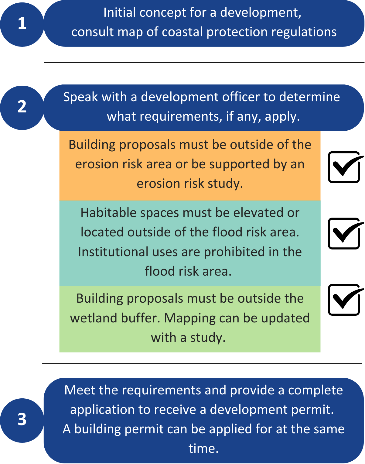
Erosion Risk Area: The Coastal Erosion Risk Area is designed to protect properties from erosion and preserve ecosystems. Development cannot occur within 30 m from the top of the bank or the ordinary high watermark if the bank is indiscernible. No natural vegetation may be removed within 15m from the top of the bank or the ordinary high watermark.
Flood Risk Area: The Flood Risk Area identifies coastal regions most vulnerable to flooding from tides, sea level rise, and storm surge, projecting total inundation by 2100. No buildings in these areas can have habitable spaces below 3.97m of CGVD 2013. Institutional uses are strictly prohibited within the Coastal Flood Risk Area, regardless of elevation.
Wetlands: Development within 30 metres of Coastal Wetlands is prohibited.
Looking to develop or renovate near the Coast? Take a look at the flow chart below to understand potential next steps:

For more information about how the regulations came to be, please visit Engage MODL.
Coastal Erosion Risk Factor Assessment (CERFA)
Section 4.14.1 of the Land Use By-law requires a 30-metre horizontal setback from the top of the bank for new development. However, Section 4.14.5 of the Land Use By-law allows for a reduction in the setback, down to a minimum of 15 metres, only if a Coastal Erosion Risk Factor Assessment (CERFA) demonstrates that the erosion rate is slower than the planning horizon of 77 years.
The Municipal Guidelines document provides an overview of what must be included when submitting a CERFA to the municipality. The Technical Background and Guidance document is the full report.
CERFA Technical Background and Guidance